
FORT ERIE WATERFRONT MASTER PLAN
Fort Erie, ON
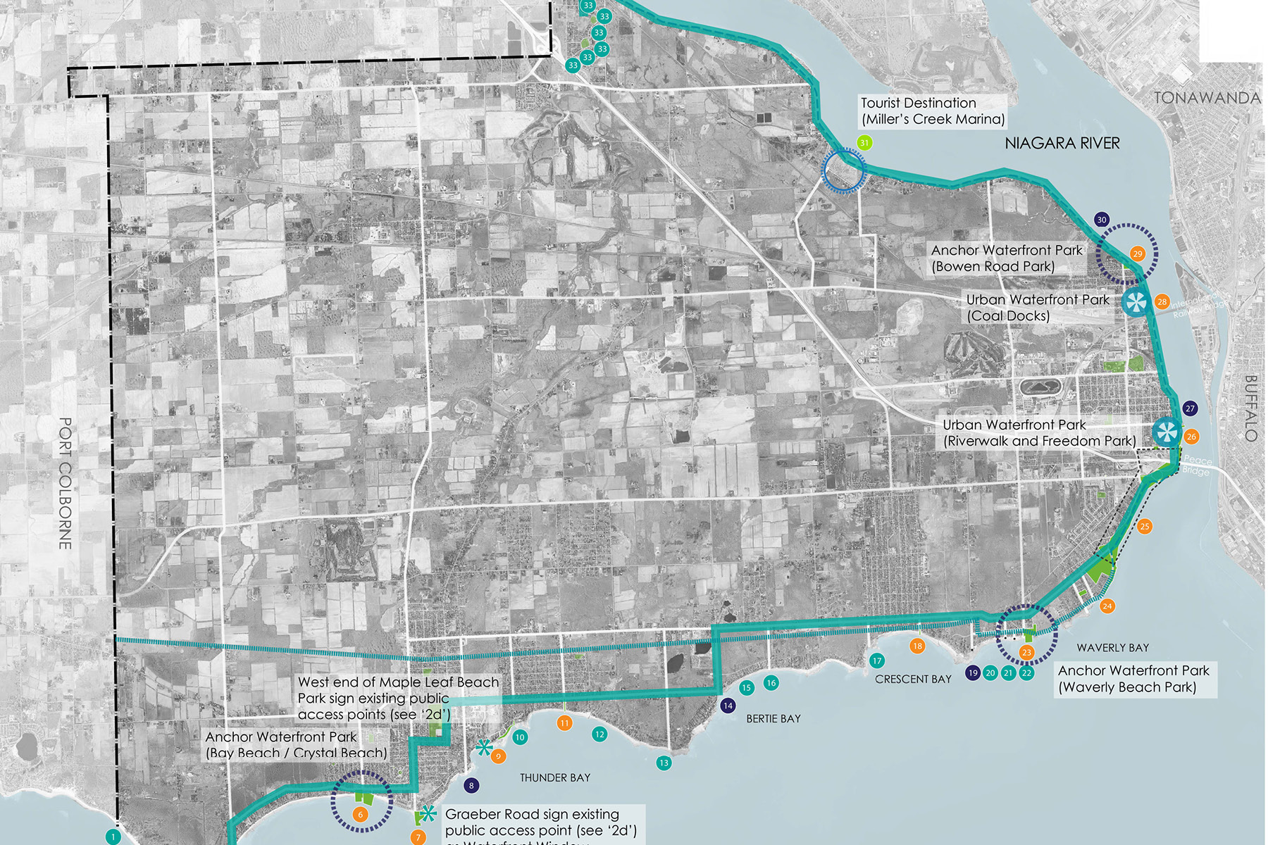
Fort Erie’s waterfront has always been its key defining element: from the earliest First Nation’s settlement, to the War of 1812, to tourist destinations through the early 1900’s, to the stunning setting for waterfront summer houses built through the 1900’s. Today, the waterfront presents a vast array of conditions and character along its length. The town has long recognized the value of its waterfront as its most valued natural asset. Over the years, between the Peace Bridge to the town’s western boundary, 24 sites have been secured for public access to the water’s edge.
The Fort Erie Waterfront Strategy establishes a broad-based vision for Fort Erie’s 45 km of water’s edge land along Lake Erie and the Niagara River. The strategy identifies opportunities to improve/augment parks, town-owned land, destinations, and attractions along the Lake Erie and Niagara River shoreline and ensures that residents and visitors have access to the water’s edge and associated amenities.
The Waterfront Strategy was presented within the context of a vision and its underlying principles were developed and supported through extensive community consultation. The strategy consists of “Seven Frameworks” and emerged through the following stages of project exploration: existing conditions; key issues; “what we heard” through community engagement; principles; and specific actions. The final report identified 53 initiatives including marketing, capital projects, guidelines, and policy recommendations.